
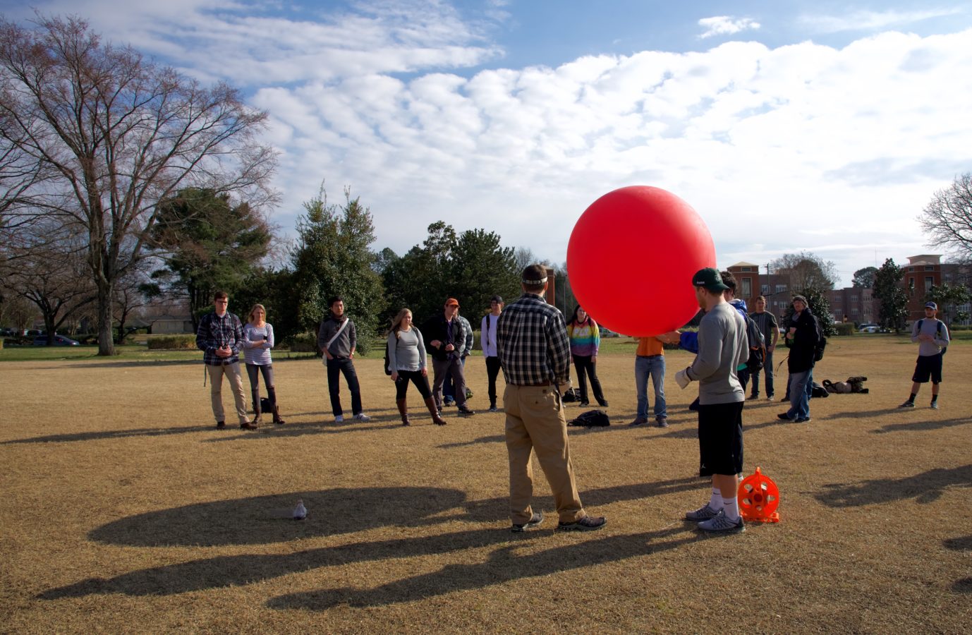
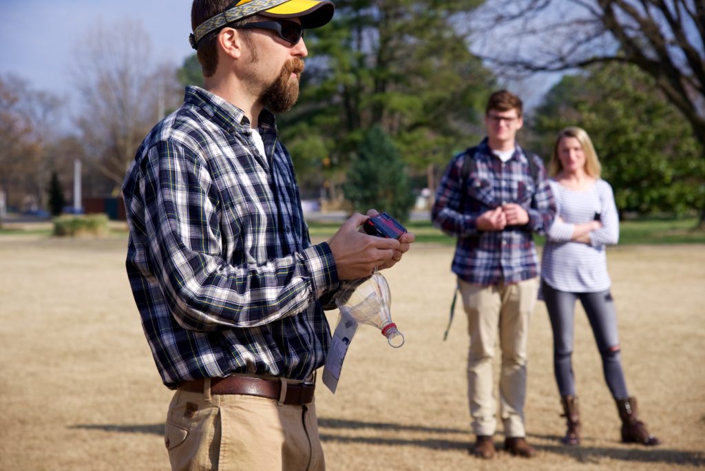
A team of UNC Charlotte students capitalizes on blue skies with scattered clouds, working together to prepare a giant red balloon for liftoff. It takes six of them to hold the balloon and fill it with air, before they guide the orb to an open field near the main campus entrance. There, teaching assistant Adam Griffith dons leather gloves, grasps the sturdy 1,000-foot string and sends the balloon skyward.
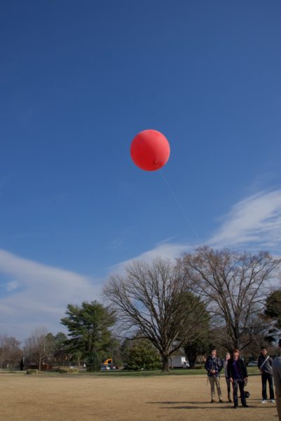
The wind picks up velocity, making for a swift and steady liftoff. Students turn their faces to the sky, shading their eyes from the sun as they watch their creation take flight. They have attached a camera to the string to take aerial photographs of the UNC Charlotte campus, as part of their geography class on spatial thinking. Later, they will use the photographs to create a map for further study.
“One of the main objectives of this course is for students to cultivate a spatial thinking habit of mind,” says Elizabeth Delmelle, assistant professor in the Department of Geography and Earth Sciences, who teaches the class.
Using the lab exercise, the scholars gain hands-on experience that expands their understanding of the concept, which offers a geographic perspective on how objects, processes and phenomena relate to each other in time and space. We use this habit of mind when we set the table for dinner, when we pack a suitcase, when we read a map, or when we parallel park, for example.
“Geospatial technologies – such as maps, remote sensing imagery, GPS, and other tools – are used with spatial thinking to address real-world problems,” Delmelle says. “These technologies enable us to visualize and quantify spatial relationships in a concrete way.”
 Through the lab activities in the class, students apply what they are learning in the classroom to enhance their spatial thinking skillset. In this specific exercise, they are exploring the natural world from a bird’s-eye view.
“We certainly have a different perspective of the earth being able to see it from above,” says environmental studies student Caroline Brinegar.
On this particular day, wind gusts make for a struggle for a one-person operation. Bringing the large-scale balloon back to the ground takes a few helping hands. Pulling hand over hand, the students haul the tethered balloon down and detach the camera. Now it is time to sort through the photos collected and see what images can be pieced together to create a map.
Back in the lab, students use computers to sort through hundreds of digital photos in search of the best ones. With a free online tool called MapKnitter, they puzzle-piece the images together, forming a map.
“In class, we talk about clues used to identify features from above, such as the texture, shape, size, situation, and association of features,” Delmelle says. The balloon mapping exercise helps students understand scale and resolution, which are primary spatial thinking components. They also better understand how maps are created.
“As products such as Google Earth and Google Maps make remote sensing and mapping technology more freely available to everyone, it is important to have an understanding of what exactly these maps mean and how they can be used appropriately,” Delmelle says.
 In the past, these types of images were available only to people with access to expensive tools, such as planes or satellites. While Google Earth and Google Maps now offer free access to images, the photographs often are not current.
“Google Earth photographs or other freely available imagery are representative of one single snapshot in time, often several years old,” Delmelle says. “If we wish to have more up-to-date images, we need to either take our own or purchase them from private companies.”
The balloon mapping tools cost roughly $250. “One of the really important parts of what we’re doing today is that this shows the students that this is a tool that people without a lot of money can access as well,” Griffith says.
Using real-time images allows people to see what is occurring with a degree of immediacy.
“This is especially important for monitoring environmental disasters, for example,” Delmelle says. “Adam gives an example of his work in mapping the deep water horizon oil spill a few years ago off the coast of Louisiana. In order to quantify the extent of the problem, we need real-time, up-to-date imagery to see how it has spread, where to, and what it might impact. These are all inquiries directly tied to our definition of spatial thinking.”
The students in the UNC Charlotte class are taking away not only the practical lessons learned, but also this deeper sense of the effects that human interaction has on the planet.
“It’s important to be aware of your impact,” says geography student Alexander Bryant. “I think a lot of people aren’t aware of how their actions impact the Earth. As long as you’re aware, you can have a pretty good idea of what you can do to minimize that impact or make it more positive.”
Words: Hannah Rayburn, CLAS Intern | Images: Lynn Roberson, CLAS Communications Director | Video: University Broadcast team


